


| Google Maps View of Eagle Lake Google Street Views is Also Available on Rt. 74. |
|
View Larger Map |
| i-Boating: Free Marine Navigation Charts & Fishing Maps |
|
View Larger Map |
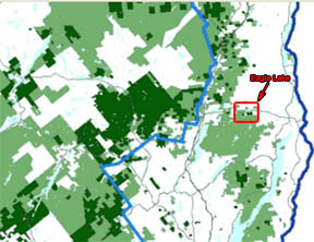
| ARGIS Maps View of Eagle Lake Adirondack Regional Geographic Information System |
 View Larger Map |
ARGIS Adirondack Park Webmap Viewer Provides zoom-able, scroll-able, feature inclusion/exclusion and measure tools for the Adirondack Park |
 View Larger Map |
| Septic Dye Test Results Map (Due to the presence of personal information these files require a password to access) |
 |
| For a .pdf version of this map click here. Please see our final report here. |
| APA Wetlands Map |
 |
| For a .pdf version of this map click here. |
| APA Permit Maps Page |
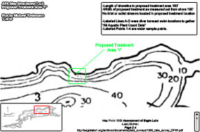 |
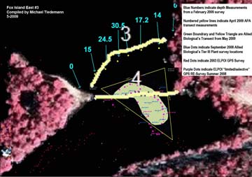
| Jacques "Eagle Lake Depths, Milfoil Beds, and Matting - Ti Bay 2009" |
 |
| For a .pdf version of this map click here. |
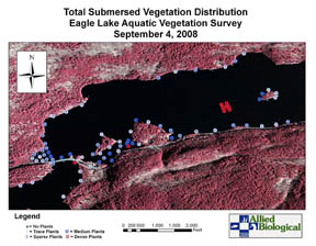
| 2008 Eagle Lake Aquatic Vegetation Location Page |
 |
| APA Land Use Classifications Map Page |
 |
| Inflow and Outflow Locations |
 |
| For a .pdf version of this map click here. |
| Water Intake Locations |
 |
| For a .pdf version of this map click here. |
| Lake Usage Density Map |
 |
| For a .pdf version of this map click here. |
| 2008 and 2009 Work Locations Page |
 |
| Proposed Herbicide Treatment Sites Page |
 |
| Curtain Transect Maps Page |
 |
| November 2008 Overlay Map |
 |
| For a .pdf version of this map click here. |
| Eagle Lake Milfoil selective re-Survey 2008 (when available) |
 |
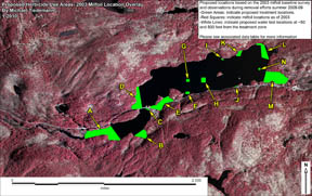
| Eagle Lake Milfoil Survey 2003 Page |
|
| 1994 Eurasian Water Milfoil Location Map |
 |
| For a .pdf version of this map click here. |
| 1989 Eurasian Water Milfoil Location Map |
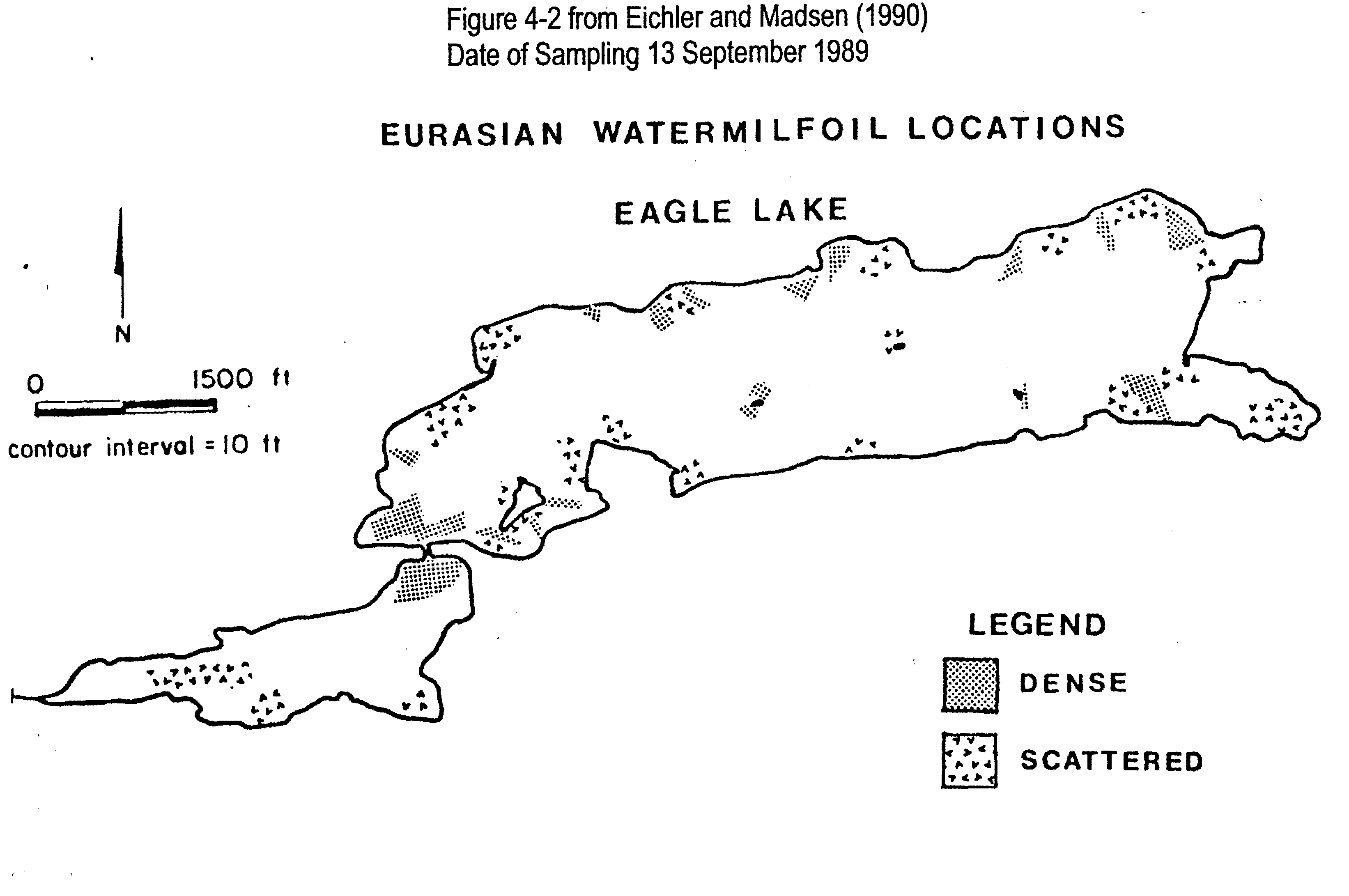 |
| For a .pdf version of this map click here. |
| 1989 Benthic Map with Suggested Milfoil Growth Locations |
 |
| For a .pdf version of this map click here. |
| Eagle Lake Property Maps Page |
 |
| NYS Forest Preserve Page |
 |
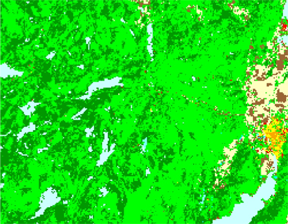
| APA Land Cover Classification Map Page |
 |
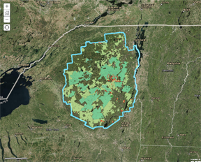
| Eagle Lake Watershed (Allied Biological) |
 |
| For a .pdf version of this map click here. |
| Adirondack Park 1972 State Land Master Plan (SLMP) Map | ||
Map Key |
Eagle Lake View |
 |
| For a .pdf version of this map click here. | ||